Record-high temps Wednesday… Snow today continues Winter of 2021-2022’s ‘Yo-Yo Adventure’ this week
Last three official weeks of winter historically known to be wildly unpredictable (and stormy)
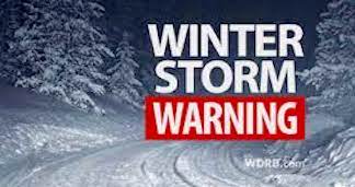
Another major Nor’easter was forecast to hit the Greater Boston area and the entire northern and southern New England area beginning early this morning, threatening to dump up to a foot of snow.
Though today’s expected storm was not forecast to be accompanied by the usual strong winds associated with similar winter weather events, a nasty mix of sleet and freezing rain should be coming by early afternoon to cause a messy and potentially hazardous evening commute.
With schools already closed in Everett, Malden, Revere and Saugus due to the February Winter Break week, that aspect of the respective cities’ operations will not be affected. In Malden, municipal offices in City Hall are already closed on Fridays due to their regular Monday-Thursday schedules.
Residents of Everett (cityofeverett.com), Revere (revere.org) and Saugus (saugus-man.gov) should check the city websites for information of possible schedule changes and weather/snow-related decisions. The city of Malden’s municipal website address is cityofmalden.org.
If any of The Advocate readership communities determine if a Snow Emergency (and related parking restrictions) are to go into effect, such information would be available on the respective websites.
The “Winter of 2021-2022” continues to be a real-time “Yo-Yo Adventure” in this region — even this week— with dramatic changes in temperatures and weather conditions.
Just this week, a record-high temperature of 69 degrees rolled in Wednesday, as shorts and t-shirts were in abundance as a mix of sun and clouds were accompanied by the late spring-like high.
All that changed Thursday, as early morning commuters saw temperatures in the high teens, a drop of about 50 degrees in less than 12 hours.
Coupled with today’s anticipated snowstorm, this represents still another “peaks and valleys” effect, weather-wise. “Only in New England” continues to be the battle cry of local residents and city officials, who are forced to rapidly shift gears to combat weather shifts.
Malden Department of Public Works (DPW) Chief Bob Knox, a veteran of over two decades of New England winters has seen plenty of the unpredictability that winter brings to this region, particularly in the later stages of the official winter season.
Knox said that state-of-the-art forecasts from various sources are highly accurate; there is always the possibility of an unexpected, unforeseen shift in a weather pattern.
As weather mavens in this area can attest, that is why most of the media-driven weather forecasts often “hedge their bets” by offering explanations of different “models” of what could potentially happen, if certain variables came to light.
Already this year, the greater Boston area’s snowfall been more than double the previous two year’s full season snowfalls. So far, 48.1 inches of snow has fallen this winter, surpassing the very light winter snowfall totals of the past three years — 2021 (21.8 inches), 2020 (21.6 inches), 2019 (38.7 inches)— and close to being more than four of the next five years before that.
The Blizzard of 2022, on January 29-30, was about half of that total for this year, a 23.8-inch deluge of snow.
After today’s snowfall, forecast to be between 8-12 inches in greater Boston, this year’s total would be 56-60 inches.
That would be higher than 2018 (51.0 inches), 2017 (50.9 inches), 2016 (41.2 inches) and 2014 (50.2 inches).
The only mark of the past 10-12 years of snowfall totals that seems out of reach for this year’s total, which could easily be 70-90 inches, would appear to be 2015, when 108.6 inches of snow fell during a whopping 21 days of snowfall events.
At this point, however, “Never say never” has to be the mantra, as another blizzard day of 20-plus inches of snow could jack up the totals and as we all well know, we are far from out of the woods, even when March arrives.
It is a rare year when no snow falls in March at all around greater Boston. Spring season officially begins on Sunday, March 20— three weeks away this weekend— but that calendar date means nothing to the dynamic duo of neither Mother Nature or ‘Ole’ Man Winter.
They will each change seasons when they are good and ready, calendar or no calendar, and not before.
Happy shoveling and plowing this weekend, everyone.